
![[EBOOK] Practical Guide to Geospatial AI in Cities.](https://www.deepblock.net/hs-fs/hubfs/Blog%20Components/E-Book%20-%20Using%20Geospatial%20AI%20in%20Cities_%20A%20roadmap%20to%202025-min.png?width=500&upsize=true&name=E-Book%20-%20Using%20Geospatial%20AI%20in%20Cities_%20A%20roadmap%20to%202025-min.png)
[EBOOK] Practical Guide to Geospatial AI in Cities.

21 June 2023
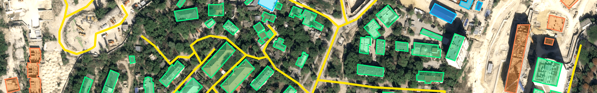
Geospatial data and machine learning are two transformative technologies revolutionizing the field...
3 minutes read


