The Power of Remote Sensing for Re-Insurance
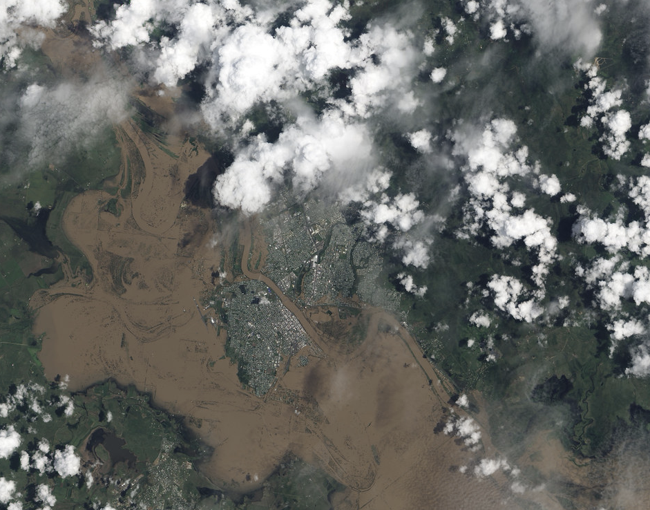
Discover how remote sensing technologies can revolutionize the re-insurance industry and provide valuable insights for risk assessment and underwriting.
Understanding Remote Sensing in Re-Insurance
Remote sensing is the process of collecting data about an object or phenomenon from a distance, typically using satellites or aircraft. In the context of re-insurance, remote sensing plays a crucial role in understanding and assessing risk.
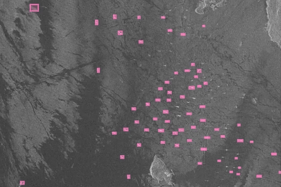
Sea surveillance through satellite imagery is essential for monitoring pirate activities.
By analyzing data captured from remote sensing technologies, re-insurance companies can gain valuable insights into various aspects of risk, such as natural disasters, climate conditions, and property assessment.
Remote sensing involves the use of sensors and instruments to capture data, including images, thermal radiation, and electromagnetic waves. This data is then analyzed to extract meaningful information and patterns.
In the case of re-insurance, remote sensing data can help identify areas prone to natural disasters, assess the condition of properties, and monitor changes in environmental factors that may affect risk levels.
With the advancements in remote sensing technologies, re-insurance companies can now access high-resolution imagery, and sophisticated analytical tools. This allows them to make more accurate risk assessments, underwrite policies with greater precision, and effectively manage their portfolios.
Overall, understanding remote sensing in re-insurance is essential for leveraging the power of data and technology to mitigate risks, enhance underwriting practices, and ultimately improve the overall efficiency and profitability of the re-insurance industry.
The Role of Remote Sensing in Risk Assessment
Risk assessment is a crucial component of re-insurance, and remote sensing plays a significant role in this process. By leveraging remote sensing technologies, re-insurance companies can gather valuable information about the risks associated with a particular location or property.
Remote sensing data can provide insights into various risk factors, such as natural disasters, climate patterns, and crop yield prediction. For example, satellite imagery can help identify areas prone to hurricanes, floods, or wildfires. By analyzing historical data and monitoring real-time changes, re-insurance companies can assess the likelihood and severity of potential risks.
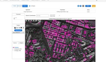
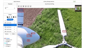
Furthermore, remote sensing can also help in assessing the vulnerability of properties to natural disasters. By analyzing high-resolution imagery and using advanced algorithms, re-insurance companies can determine the condition of buildings, infrastructure, and other assets. This information is crucial for accurately underwriting policies and setting appropriate premiums.
In summary, remote sensing plays a vital role in risk assessment by providing re-insurance companies with valuable insights into the risks associated with specific locations, properties, and environmental factors. This enables them to make informed decisions and effectively manage their risk portfolios.
Applications of Remote Sensing in Underwriting
Underwriting is another area where remote sensing technologies can have a significant impact. By leveraging remote sensing data, re-insurance companies can enhance their underwriting practices and improve the accuracy of their risk assessments.
Another application of remote sensing in underwriting is the assessment of geopolitical instability. By leveraging high-resolution imagery and applying advanced machine learning algorithms, re-insurance companies can anticipate geopolitical instability in conflict-prone regions and assess the impact of conflicts on the global economy and insurance products. Intelligence is crucial not only for government agencies, but also for insurance and financial companies, and satellite images provide valuable recent data.
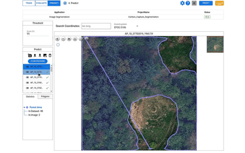
Remote sensing can also be used to assess the environmental factors that may impact risk. For example, by analyzing satellite data, re-insurance companies can monitor climate patterns, changes in vegetation, or geological conditions that may increase the likelihood of certain risks. This information can be used to adjust underwriting policies, set appropriate premiums, and effectively manage risk exposure.
Overall, the applications of remote sensing in underwriting are vast and varied. By leveraging this technology, re-insurance companies can improve the accuracy of their risk assessments, streamline their underwriting processes, and make more informed decisions.
Role of Remote Sensing in Assessing Disaster Damage
One of the key areas where remote sensing can make a significant impact in re-insurance is in assessing disaster damage. When a natural disaster strikes, re-insurance companies need to quickly assess the extent of the damage and estimate the financial impact.
Remote sensing technologies, such as satellite imagery and aerial surveys, can provide comprehensive and timely information about the affected areas. By analyzing before-and-after images, re-insurance companies can identify the areas and properties that have been impacted by the disaster. This information is crucial for accurately estimating the losses and processing claims efficiently.
Furthermore, remote sensing can also be used to assess the severity of the damage and prioritize response efforts. For example, thermal imaging can help identify areas with structural damage or potential safety hazards. This information can aid in the allocation of resources and the implementation of effective recovery strategies.
In summary, remote sensing plays a crucial role in assessing disaster damage by providing re-insurance companies with timely and accurate information about the affected areas. This enables them to respond quickly, estimate losses accurately, and facilitate the recovery process effectively.
Challenges and Limitations of Remote Sensing in Re-Insurance
While remote sensing technologies offer numerous benefits for re-insurance, there are also some challenges and limitations that need to be considered.
One of the main challenge is the interpretation and analysis of remote sensing data. Extracting meaningful information from raw data requires advanced algorithms, expertise in data analysis, and in-depth understanding of computing and machine learning. Re-insurance companies must seek out a capable analytics provider that can offer robust analytical capabilities, enabling them to fully harness the potential of remote sensing technologies.
Despite the challenge, the benefits of remote sensing in re-insurance outweigh the limitations. With continuous advancements in technology and data analytics, re-insurance companies can overcome these challenges and unlock the full potential of remote sensing in managing risk and enhancing underwriting practices.
The Future of Remote Sensing in Re-Insurance
The future of remote sensing in re-insurance looks promising, with ongoing advancements in technology and data analytics.
One of the key areas of development is the integration of remote sensing data with artificial intelligence (AI) and machine learning algorithms. By combining the power of remote sensing with AI, re-insurance companies can automate the analysis of large volumes of data, identify patterns, and make predictions with greater accuracy. This can significantly enhance risk assessment, underwriting processes, and portfolio management.
Additionally, advancements in remote sensing technologies, such as improved spatial resolution and enhanced sensor capabilities, can provide more detailed and accurate information for risk assessment and underwriting. This can lead to better pricing models, improved risk management strategies, and enhanced profitability for re-insurance companies.
In conclusion, the future of remote sensing in re-insurance is bright. By leveraging the power of technology, data analytics, and continuous innovation, re-insurance companies can unlock the full potential of remote sensing and revolutionize the industry.


