How to export GEOJSON in Deep Block
In this post, we will learn the process of exporting annotations created using Deep Block in the GEOJSON format. Whether it's the objects or changed area identified by your machine learning model inference, we'll guide you through the steps to export them in GEOJSON format.
If you are not familiar with GEOJSON, get to know more about GEOJSON in this article.
Step #1 - Run an inference or Draw Something in Train mode
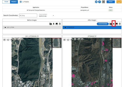
- First, create a project in Deep Block, upload an image, then run inference with your trained model
- Or draw something on the uploaded image in train or evaluate mode.
- Deep Block supports GEOJSON export only for images in GEOTIFF format. When uploading other types of images, bounding boxes or polygons can only be exported in COCOJSON format.
- Click on "JSON download" button to download the GEOJSON file.
- Currently, GEOJSON export is supported only for Image Segmentation, Object Detection, and Bi-temporal Change Detection.

Step #2 - Downloading GEOJSON
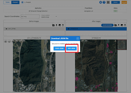
- Click on the "GEO JSON" button.
- Then you can download all annotation in one mode (TRAIN, EVALUATE, or PREDICT) as GEOJSON files.
- One GEOJSON file corresponds to one image file.

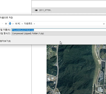
- You can download multiple JSON files in a ZIP file.

Step #3 - Use your GEOJSON in GIS software
- Once you've completed the process, simply unzip the file and locate the corresponding GEOJSON file for the GEOTIFF image you wish to analyze.
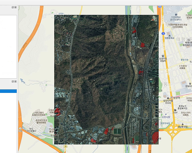
- From here, you can seamlessly integrate the exported GEOJSON into your GIS application or utilize the downloaded GEOJSON in any other compatible software.
- The screenshot below is QGIS. We uploaded the extracted GEOJSON data from Deep Block onto an aerial photograph of the Seongnam City, Republic of Korea.

Or if you are interested in our API service, please contact us.

