Transforming cities through advanced geospatial analysis.
Urban planners are confronted with a daunting task: extracting valuable insights from vast geospatial data to make well-informed decisions. However, the traditional methods of data analysis and manual interpretation prove to be time-consuming and ineffective, impeding the efficient resolution of crucial challenges such as infrastructure management, environmental sustainability, and disaster preparedness.
Enter Deep Block, an AI-powered geospatial analysis platform meticulously crafted to overcome these obstacles. By harnessing state-of-the-art computer vision technology, Deep Block empowers urban planners and decision-makers to dedicate their attention to meticulous analysis and strategic decision-making, all while automating the laborious tasks of data processing and interpretation.
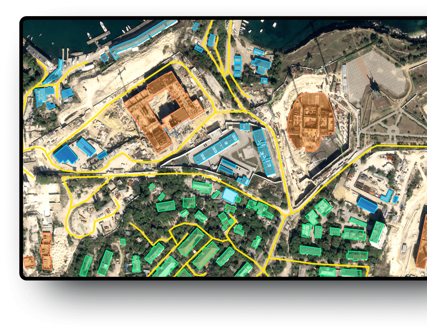
Unearthing Urban Intelligence.
Deep Block Platform revolutionizes urban planning and decision-making processes by leveraging the power of AI and machine learning. With Deep Block, anyone can harness the wealth of geospatial information through repeatable and automated processes, enabling efficient analysis and insights. The platform excels in processing high-resolution imagery with remarkable speed and scalability.

Satellite Imagery
Sattelite imagery can offer valuable observations to understand large city landscapes such as building, infrastructure, and population density and distribution across cities.

Aerial Photography
Aerial imagery, obtained from planes or helicopters, complements satellite data by offering consistent results and minimizing atmospheric artifacts. Although it covers a smaller area, aerial photography delivers high-quality and reliable information for urban planning applications.

Drone Imagery
Drones have emerged as a valuable asset in urban planning, providing targeted studies and reconnaissance. While their range is relatively limited compared to planes, drones offer flexibility and precision in capturing imagery for specific areas of interest.
Unlocking data blind spots.
Deep Block's advanced computer vision algorithms revolutionize the field of urban planning and smart cities by harnessing the power of geospatial data. Our platform empowers urban planners to efficiently process and analyze large volumes of data, enabling them to make informed decisions and drive sustainable urban development.
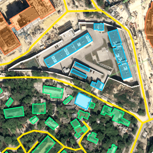
Land Use and Zoning Analysis
Identify and classify different land use categories, such as residential, commercial, industrial, and recreational areas through time. This information aids in effective urban development planning, optimizing land utilization, and detecting illegal constructions.
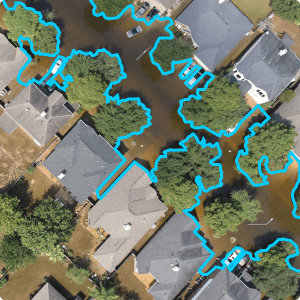
Disaster Preparedness and Response
Analyze real-time data from various sources, including drone imagery and CCTV footage, to aid in emergency response planning and post-disaster damage assessment. This enables proactive measures, efficient resource allocation, and effective recovery strategies for cities and their residents.
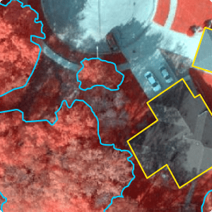
Environmental Conservation
Detect and track changes in vegetation, identify potential areas of environmental concern, and support initiatives related to urban greening and sustainable development. These insights contribute to the creation of environmentally friendly and livable cities.
Unleash the Geospatial Toolbox.
Deep Block supports a growing range of applications and lets you train your AI on multiple data sources.
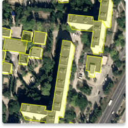
Image Segmentation
Assign pixel-level labels to different regions within an image. Applied to geospatial data, it can help identify buildings, land-use patterns, vegetation cover, or even changes over time. This level of granularity enables cities to monitor and analyze spatial dynamics, supporting environmental assessments, infrastructure planning, and urban growth modeling.
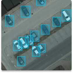
Object Detection
Recognize objects and precisely locate them within the geospatial context. By detecting and delineating individual objects, such as vehicles, trees, or infrastructure elements, cities can gain insights into spatial distribution patterns and make informed decisions accordingly.
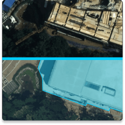
Change Detection
Discover and identify discrepancies in ground objects using two (bi-temporal) or more (multi-temporal) images taken by the same type of sensor, at the same geographical location. It can indicate the addition or removal of buildings which is one of the main uses for urban and public space management, cadastral map update, and illegal constructions detection.
What We Did
Over the years, we have been dedicated to creating innovative machine vision projects that effectively analyze remote sensing images for customers across the globe. Deep Block's widespread user base is a testament to our commitment to constantly enhance our services and technology.
Urban Planning & Management
We collaborate with various public institutions in South Korea, monitoring changes on the ground and land use, contributing to citizen safety and sustainable development.
Precision Agriculture & Forestry
We are conducting AI-based monitoring of food production and land use patterns in collaboration with the South Korean government, research institutions, and statistical agencies. In addition to crop yield prediction, utilize Deep Block and aerial imaging for pest surveillance and early detection of disease outbreaks!
Maritime Awareness & Hydrology
We partner with South Korea's water public enterprise, K-water, and have the technology to quickly identify changes and pollution in the expansive ocean, as well as monitor ships.Construction & Naval Architecture
We have conducted construction site monitoring and object identification tasks using drones in collaboration with the world largest shipbuilding company and South Korea's largest construction companies.
Defense & Surveillance
Satellites, drones, and aerial imagery are widely used for IMINT, surveillance, and homeland security.
The world's fastest imagery analysis solution.
Deep Block's patented deep learning technology can process large file sizes instantly. This makes for a powerful solution to analyze satellite, drone, and aerial imagery.

10 GP pixels
Max file resolution
or 100,000 x 100,000 pixels images.

40 GB
Max file size
vs. 1 GB with our competitors.

10GB/sec.
Processing
speed.

0.9 AP
Highly accurate prediction
when detecting objects.

0.9 Recall
Highly reliable detection
with minimum false negatives.
When confidentiality and security are not only buzzwords.
At Deep Block, we understand the needs of large enterprises and public organizations and are willing to work closely with your team to ensure a smooth deployment and usage of the solution.
Advanced Security
Get additional security features to fit your compliance needs like VPN connection, monitoring, fixed IP, and others.
Custom Domain
Get your own enterprise account, allocated users seats, and branded domain.
Self-Hosting Support
Host Deep Block in your own private cloud or on-premise for maximum security.
Access Provisioning
Define user accesses and privileges to make sure that the right person has access to the right information.
Workflow Customization
Request custom interfaces, features, or workflows directly from our engineering team.
Premium Support
Our support team will be monitoring your needs on the clock to ensure a smooth Deep Block experience.
Interested? Let's get in touch!
Whether it is to get a demo of our Deep Block Platform, inquire about our learning courses, join our latest Bootcamp or explore custom solutions with us, we will be happy to help!


.png?width=1200&length=1200&name=SAR%20%EC%9C%84%EC%84%B1%20%EC%82%AC%EC%A7%84%EC%97%90%EC%84%9C%EC%9D%98%20%EB%B9%84%ED%96%89%EA%B8%B0%20%ED%83%90%EC%A7%80(with%20Hexagon%20%EB%8F%85%EC%9D%BC%20%EC%A7%80%EC%82%AC).png)


.png?width=1200&length=1200&name=oil%20tank%20(1).png)