Keep your analysts sharp. Keep your troops safe.
The frequent changes on the ground are captured every moment by thousands of reconnaissance satellites.
Each image captured by these advanced satellites reaches sizes of tens of gigabytes, and tens of thousands of such photos are taken daily.
Traditionally, these images are analyzed by the human eye alone, but the introduction of machine vision technology to handle such massive imagery has fallen short in the market.
Introducing Deep Block, an extraordinary solution capable of analyzing massive images and vast quantities of remote sensing imagery at incredible speed.
Deep Block is a no-code GEOAI platform for developing machine learning models that can be seamlessly integrated into your institution's internal infrastructure.
With this powerful platform, you can swiftly analyze immense images and swiftly uncover critical enemy activities.
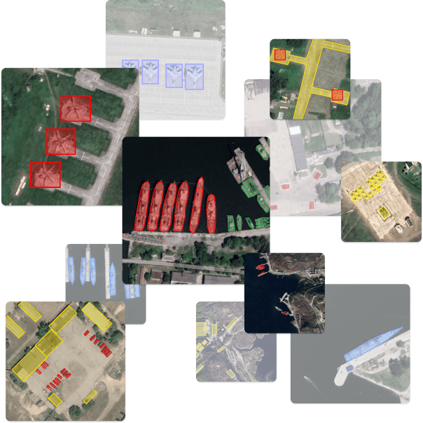
Intelligence
analyzed "on the fly".
With the Deep Block Platform, anybody can leverage that wealth of information by creating repeatable and automated processes using AI and Machine Learning. Deep Block has the capability to process high-resolution imagery at speed and scale.

Satellite Imagery
VHR satellite instruments can observe hazardous environments without putting people or equipment at risk. Their imagery can cover a wide area and are available on demand.

Aerial Photography
Compared to satellites, aerial imagery coming from planes or helicopters has a smaller coverage but can produce more consistent results and avoid atmospheric artifacts.

Drone Imagery
Drones play a growing role on the battlefield and in military reconnaissance and security surveillance operations. They offer good results for targeted studies but have a lower range than planes.
Avoid missing critical information.
Computer vision is useful both on and outside the battlefield. Deep Block can help your IMINT analysts process large amounts of information collected by remote sensing imagery systems. Our powerful computer vision algorithms can automatically perform the initial filtering of the most relevant data and pre-process all the raw information at your disposal.
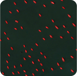
Maritime Domain Awareness
Advanced maritime intelligence, surveillance, and reconnaissance missions are now powered with AI. Analyze ship traffic, detect and classify vessels and equipment at sea or at port, and automatically alert your analysts when any change or threat is detected.
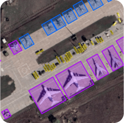
Air Situation Monitoring
Collect information related to the enemy’s air force strength, movements, and activity on land, in the air, or at sea. Train your AI to detect, classify, and inventorize any type of aircraft and airfields infrastructures and capabilities.
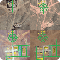
Strategic Sites Monitoring
Even during peaceful times, gathering crucial information on the enemy's critical installations and presence inside its territory is the key to combat readiness. Deep Block can help you detect and classify any object, vehicle, troop movement, and building construction over time.
Use all the arsenal at your disposal.
Deep Block supports a growing range of applications and lets you train your AI on multiple data sources.
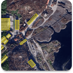
Electro-Optical
(EO)
High-performance EO sensors can generate sharp images and capture an accurate depiction of millions and millions of square kilometers. Deep Block excels in analyzing these images to enable persistent strategic site monitoring and timely decision-making.
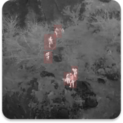
Infra-Red
(IF)
Often used in military surveillance or in search and rescue operations in near or total darkness, aerial IR imagery can be analyzed using Deep Block to automatically detect troops or vehicular presence and activities on the grounds.
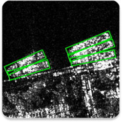
Synthetic Aperture Radar
(SAR)
Used for border security, countering drug trafficking operations, and disaster preparation & response, SAR excels in degraded environments. Automate SAR image analysis to monitor the world at any time, even at night or on cloudy days.
The world's fastest imagery analysis solution.
Deep Block's patented deep learning technology can process large file sizes instantly. This makes for a powerful solution to analyze satellite, drone, and aerial imagery.

10 GP pixels
Max file resolution
or 100,000 x 100,000 pixels images.

40 GB
Max file size
vs. 1 GB with our competitors.

10GB/sec.
Processing
speed.

0.9 AP
Highly accurate prediction
when detecting objects.

0.9 Recall
Highly reliable detection
with minimum false negatives.
When confidentiality and security are not only buzzwords.
At Deep Block, we understand the needs of large enterprises and public organizations and are willing to work closely with your team to ensure a smooth deployment and usage of the solution.
Advanced Security
Get additional security features to fit your compliance needs like VPN connection, monitoring, fixed IP, and others.
Custom Domain
Get your own enterprise account, allocated users seats, and branded domain.
Self-Hosting Support
Host Deep Block in your own private cloud or on-premise for maximum security.
Access Provisioning
Define user accesses and privileges to make sure that the right person has access to the right information.
Workflow Customization
Request custom interfaces, features, or workflows directly from our engineering team.
Premium Support
Our support team will be monitoring your needs on the clock to ensure a smooth Deep Block experience.
Interested? Let's get in touch!
Whether it is to get a demo of our Deep Block Platform, inquire about our learning courses, join our latest Bootcamp or explore custom solutions with us, we will be happy to help!

